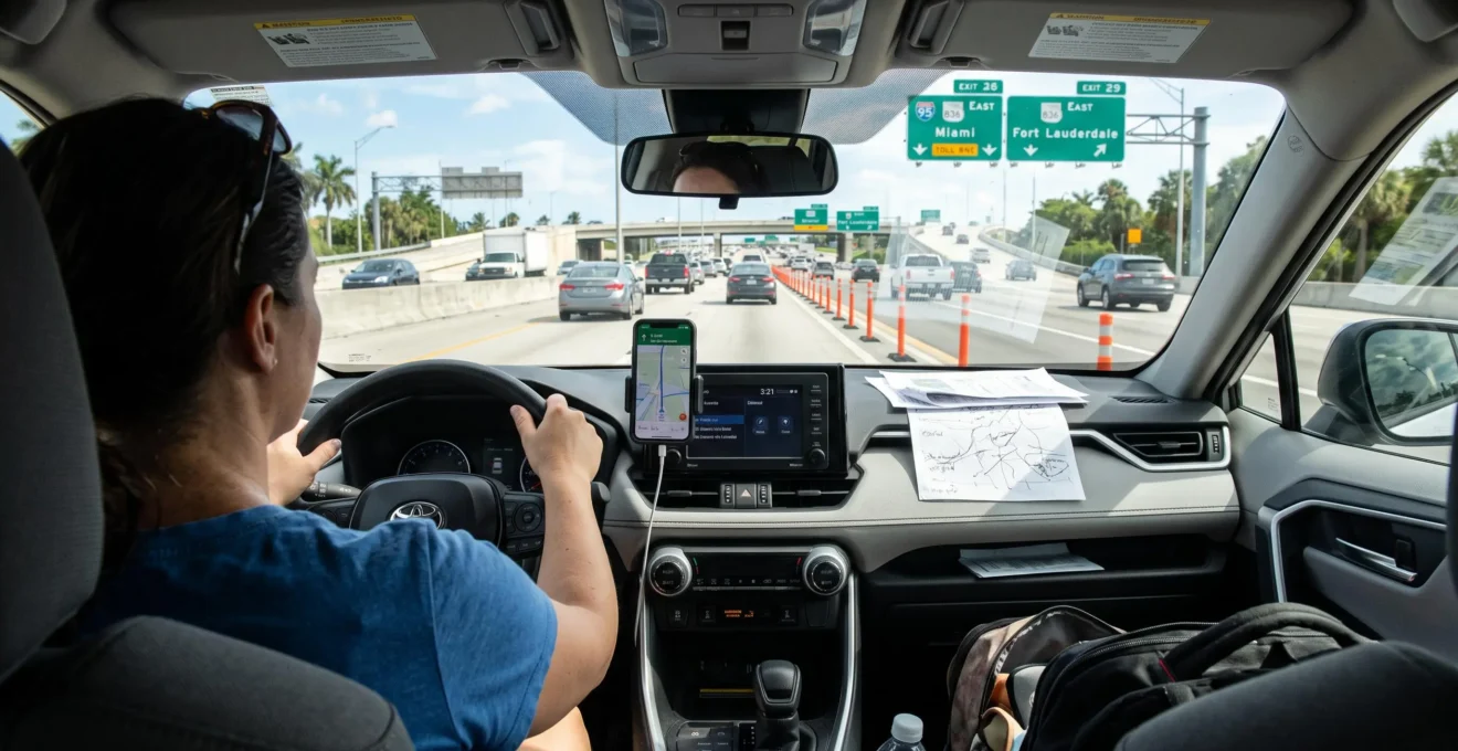
Most visitors driving a rental car in Florida do not need to pay for a separate GPS system. A smartphone running Google Maps, Apple Maps, or another suitable navigation app can usually provide the directions needed for a vacation, provided the phone has adequate power, reliable positioning, and maps covering the planned journey.
However, the best navigation arrangement depends on more than the application. Florida’s interstate interchanges, electronic toll roads, limited-access express lanes, and unfamiliar airport exits can complicate driving decisions. A navigation system that works well on an ordinary city street may still deliver instructions that are difficult to interpret while approaching several highway ramps.
Visitors also need to consider mobile data availability, international roaming costs, rental car toll policies, and whether the vehicle supports Apple CarPlay or Android Auto. A dedicated GPS becomes useful when these factors make smartphone navigation unreliable or inconvenient.
The objective is not simply to find the shortest route. It is to choose a navigation setup that gives the driver enough information to make safe decisions before reaching complicated junctions.
Florida rental car GPS: Essential points
- A smartphone is usually sufficient: Use an up-to-date navigation app, a secure display position, charging access, and downloaded maps.
- Toll settings matter: Confirm the rental company’s toll program and your route preferences before entering Florida’s expressways.
- Offline navigation provides backup: Download the entire planned driving area and preview complicated highway connections before departure.
- Why Are Some Florida Interstate Interchanges Difficult for Visitors?
- Why Can GPS Directions Become Confusing Around Florida Highway Interchanges?
- How to Set Up Reliable Navigation Before Leaving a Florida Airport?
- Built-In GPS or Google Maps: Which Is Better for a Rental Car?
- Which GPS Mistakes Can Cause Unsafe Last-Minute Driving Decisions?
- When Should You Download Offline Maps for a Florida Road Trip?
- How to Find Rental Car Pickup After Landing at Orlando International Airport?
- How to Plan a Florida Vacation Around the Right Driving Itinerary?
Why Are Some Florida Interstate Interchanges Difficult for Visitors?
Florida interstate interchanges can be difficult for visitors because several decisions often occur close together: choosing an exit, entering the correct lane, understanding toll signs, and identifying the appropriate highway connection. Unfamiliar road layouts and limited-access express lanes leave little room for hesitation, particularly when traffic is moving at highway speeds.
A driver accustomed to conventional exits may encounter multilane ramps, collector-distributor roadways, separate express-lane entrances, and overhead signs directing traffic toward different destinations. Some highway configurations include left-side exits or transitions that require advance lane positioning.
Interstate exit numbers generally follow mile-based numbering, but a single junction may display multiple route numbers, destination names, or ramp designations. Visitors can confuse a named destination on a sign with the route number shown by their navigation system.
Florida’s express lanes add another consideration. According to the Florida Department of Transportation‘s express lanes information, these optional lanes have limited entrance and exit points. Drivers need an active, properly mounted compatible transponder, rather than cash or TOLL-BY-PLATE, to use these facilities.
Entering an express lane can therefore mean remaining on that lane beyond an intended regular-highway exit. A navigation display showing two parallel carriageways may not make the access restrictions immediately obvious.
Several routes illustrate the importance of preparation:
- I-4: The Tampa–Orlando corridor combines urban interchanges, tourist traffic, and connections with other major roads.
- I-75: Longer journeys, including Alligator Alley, require attention to service opportunities and significant highway connections.
- Florida’s Turnpike: Electronic toll collection and connections with other expressways make payment arrangements and route selection important.
- Miami-area expressways: Multiple roadways and managed-lane configurations can require decisions before the desired interchange.
The difficulty is not evidence that tourists are inherently less capable drivers. It arises when unfamiliar geometry, road rules, and navigation instructions must be processed simultaneously.
A good navigation setup reduces uncertainty by presenting the next major decision early. However, even a correctly configured GPS can occasionally provide confusing directions near complex highway connections.
Why Can GPS Directions Become Confusing Around Florida Highway Interchanges?
GPS directions can become confusing around Florida highway interchanges when parallel lanes, changing ramp configurations, and route recalculations make the vehicle’s intended path difficult to interpret. Navigation software may display a route that differs from the driver’s actual roadway, while late instructions can leave insufficient time to select a lane safely.
Smartphones calculate position using satellite signals and, when available, additional positioning information. Navigation software then matches that position to its road map. The result is not always precise enough to distinguish adjacent highway lanes, especially where ramps and express facilities run close together.
This distinction matters because GPS location uncertainty is not the same as outdated map information.
| Problem | Possible explanation | Recommended response |
|---|---|---|
| Navigation appears to follow the wrong roadway | Positioning uncertainty between nearby roads or ramps | Follow current road signs and remain in a lawful lane |
| Exit shown by the app does not match the road layout | Outdated mapping or changed interchange configuration | Use posted route numbers and destination signs |
| Route suddenly changes to a toll road | Route recalculation, traffic conditions, or toll preferences | Continue safely and review the route when stopped |
| Directions alternate between nearby exits | Position uncertainty or changing route calculations | Avoid sudden maneuvers and allow a new route to calculate |
Some applications may reroute when traffic conditions change. They do not necessarily detect the specific lane occupied by the vehicle, so a sudden instruction should not be interpreted as proof that the app has identified the correct express-lane entrance.
Toll preferences introduce a separate problem. One system may prioritize the quickest journey, while another avoids toll roads. Switching between these systems without checking their settings can produce competing directions.
Drivers should recognize three warning signs: an unexpected instruction arriving with less than 500 feet remaining, guidance repeatedly switching between nearby lanes or ramps, and multiple recalculations over a short distance. These are practical warning indicators, not guaranteed evidence of software malfunction.
At highway speed, 500 feet offers only a brief opportunity to react. If the correct lane cannot be reached through an ordinary, lawful maneuver, the safest response is to continue and accept a revised route.
Navigation remains a supporting tool rather than an authority over roadway signs. Establishing the correct settings before leaving the rental facility can prevent many avoidable routing conflicts.
How to Set Up Reliable Navigation Before Leaving a Florida Airport?
Reliable navigation should be configured while the rental car is parked, before entering airport traffic. Pair the smartphone with the vehicle, establish a charging connection, enter the destination, check toll preferences, and preview the first highway connections. If connectivity or equipment is unavailable, establish an offline route before leaving the rental facility.
Airport departures require particular attention because drivers may reach major highway intersections soon after collecting their vehicles. Attempting to configure navigation on an entrance ramp creates an unnecessary distraction.
Begin by checking whether the vehicle supports Apple CarPlay or Android Auto. If it does, confirm that directions appear on the dashboard display and that navigation audio is audible. Otherwise, use an appropriately positioned, secure phone mount that does not obstruct visibility or interfere with vehicle controls.
The next decision concerns tolls. Florida rental companies may offer electronic toll payment programs using transponders or license plate recognition. Charges can include the actual tolls and additional service or administrative fees.
The official SunPass information about tolls in rental vehicles explains that programs and fees differ by rental company. A plate-based rental payment arrangement also should not be assumed to authorize entry into express lanes requiring a compatible transponder.
Review the rental agreement, identify which payment arrangement applies, and configure the navigation app accordingly. Choosing to avoid tolls may change both the first airport exit and the overall itinerary.
Five checks before driving out of the rental lot
- Confirm the destination. Save the exact hotel or first-stop address and verify its map pin.
- Connect and charge the phone. Confirm that the mounted phone or dashboard screen displays navigation and receives power.
- Set toll preferences. Identify the rental’s applicable payment program and confirm that the route matches your toll decision.
- Preview the initial route. Record the first major highway number, travel direction, and expected interchange.
- Prepare a fallback. Verify a downloaded map or alternative navigation device and save essential route notes for use when safely stopped.
Check that positioning works in the parking area. Covered garages can interfere with satellite reception, while cellular connectivity may be inconsistent indoors. An apparently inaccurate position inside a garage does not necessarily indicate a permanent problem.
If the phone is nearly discharged, no suitable display position is available, or the destination cannot be loaded, resolve the issue before departure. A written record of the first highway decisions is a useful emergency reference, but it does not replace functioning navigation for an unfamiliar trip.
Once the route is configured, the remaining question is whether a smartphone, an integrated dashboard system, or a separately rented GPS provides the best combination of reliability and convenience.
Built-In GPS or Google Maps: Which Is Better for a Rental Car?
Google Maps or a comparable smartphone navigation app is generally the more practical choice for Florida rental cars when mobile data, charging, and a safe display are available. An integrated or dedicated GPS becomes more useful when cellular access is limited or the traveler cannot rely on a smartphone. Neither option is universally superior.
Smartphone applications offer convenient route planning, traffic-aware navigation when connected, and integration with many modern vehicles. Google Maps, Apple Maps, and Waze provide overlapping capabilities, although offline features, route presentation, and traffic services differ.
A rental vehicle’s factory navigation system may operate using onboard maps without requiring the renter’s mobile data connection. However, map freshness, traffic functionality, and software capabilities vary by vehicle. An integrated screen does not automatically mean that the car includes a functioning navigation subscription.
Dedicated portable GPS devices provide another option, particularly for travelers without a suitable phone or data plan. Their usefulness depends on installed maps, software updates, device condition, and the availability of traffic information.
| Decision factor | Built-in vehicle GPS | Smartphone navigation | Dedicated rental GPS unit |
|---|---|---|---|
| Map updates | Depend on vehicle software and update history | Generally maintained through the app provider | Depend on device updates |
| Live traffic | Available only when supported and connected | Available with compatible online services | May require a supported traffic service |
| Cellular dependency | May navigate offline using onboard maps | Reduced with downloaded offline maps | Usually navigates using installed maps |
| Toll and lane information | Depends on map data and vehicle features | Depends on app, coverage, and route settings | Depends on device maps and capabilities |
| Additional rental cost | May be included or charged separately | Usually no separate navigation rental fee; data charges may apply | Usually an optional paid rental feature |
| Screen placement | Integrated dashboard position | Vehicle display or properly positioned mount | Separate mounted display |
Rental GPS pricing should be evaluated over the full rental period rather than by the advertised daily rate alone. For example, a hypothetical seven-day rental costs seven times the daily GPS charge before any applicable taxes or other fees. A phone-based solution can avoid that accessory expense, but roaming data or additional equipment may still involve costs.
For most connected travelers, the strongest arrangement is a smartphone with a dashboard display or secure mount, charging access, and offline maps stored in advance. A second navigation source can be useful as a fallback, but competing voice instructions should not run simultaneously.
International visitors without affordable US mobile data may prefer a suitable offline GPS unit or a smartphone configured for offline routing. Travelers using long stretches of I-75 or exploring remote areas should prioritize stored maps and adequate battery capacity over live traffic features alone.
Regardless of the technology selected, safe driving still depends on how the driver responds when instructions arrive too late or conflict with the actual roadway.
Which GPS Mistakes Can Cause Unsafe Last-Minute Driving Decisions?
The most dangerous GPS-related mistakes involve sudden lane changes, hard braking to reach an exit, stopping on a highway shoulder to check directions, and following a navigation instruction into a restricted roadway. These situations arise when drivers treat a late or incorrect instruction as something that must be obeyed immediately instead of allowing the route to recalculate.
Highway navigation requires advance decisions. At 70 mph, a vehicle travels approximately 103 feet per second, so an instruction delivered 500 feet before an exit leaves less than five seconds of travel time. That is a short interval for interpreting signs, checking mirrors, and finding a safe lane position.
Rather than relying exclusively on spoken prompts, preview the next two major maneuvers before entering a complicated highway segment. This provides an expectation of the correct route even when a voice instruction is delayed.
Several operational rules reduce risk:
- Missed exits: Continue to a lawful exit and let the navigation system calculate a new route. Do not reverse or make a sudden cross-lane maneuver.
- Solid lane markings and barriers: Respect roadway markings and physical separation, even when the GPS recommends a nearby exit.
- Unexpected braking: Do not stop abruptly on a high-speed roadway to reconsider directions.
- Roadway shoulders: Do not use shoulders as routine navigation-checking locations. Continue to an appropriate safe stopping place.
- Restricted roads: Follow posted access restrictions and traffic-control signs rather than an incompatible map instruction.
A passenger can help by monitoring signs or reviewing the next turn, but conflicting advice can distract the driver. Assigning one navigation system as the primary source avoids competing instructions. The passenger should communicate essential information early and calmly.
Florida’s distracted-driving restrictions also require careful interpretation. Florida Statutes Section 316.305 prohibits specified forms of manual text entry and nonvoice interpersonal communication while operating a vehicle, but expressly provides an exception for navigation purposes. This is not a blanket prohibition on all GPS use.
Legal permission to use navigation does not make every screen interaction safe. Complex address searches, changing app preferences, and reviewing alternative routes are better performed while parked.
When uncertainty appears, the default recovery strategy is simple: maintain lawful lane positioning, continue to the next suitable exit, and recalculate from a safe location if necessary.
A missed exit usually creates an inconvenience rather than a crisis. Navigation becomes considerably more resilient when the driver also has access to maps that work without mobile data.
When Should You Download Offline Maps for a Florida Road Trip?
Download offline maps before a Florida road trip whenever mobile coverage may be unreliable, roaming data is expensive, or a long drive passes through areas with limited services. This preparation is especially worthwhile for rural itineraries, routes near the Everglades and Big Cypress, and trips involving long highway segments away from major cities.
Offline maps are useful even when a traveler expects good cellular coverage. They provide a fallback if connectivity becomes unavailable, a data allowance runs out, or the phone temporarily loses service.
In Google Maps, a downloaded region can support driving navigation when the entire intended route falls within the stored area. However, offline operation does not provide live traffic information or alternative routes. These limitations are confirmed in Google’s official navigation documentation.
Coverage should not be assumed to fail throughout any specific Florida corridor. Network quality depends on the carrier, location, device, and surrounding conditions. Downloading maps is a precaution rather than evidence that a particular highway lacks service.
For a multiday itinerary, prepare the maps the evening before each driving day, preferably while connected to reliable Wi-Fi and charging the phone.
To prepare Google Maps for an offline journey, open the app, access the account menu, choose Offline maps, and select the option to download a custom area. Adjust the selection so the start, destination, major highway connections, and plausible detour corridors all appear inside the saved region.
Wait until the download finishes and confirm that the area appears in the offline maps list. Check whether the map needs updating and verify that the phone has sufficient free storage. If the route is too large for one selection, use additional overlapping downloaded areas.
The main limitations should shape the backup plan:
- Live congestion information will not be available during offline operation.
- Google Maps cannot provide alternative driving routes in the same way it does online.
- Searching for nearby services may be more limited than when connected.
- Specialized navigation details, including some lane or facility information, may vary with the application and saved map data.
- Road closures or recently changed intersections may not be reflected immediately in stored information.
Drivers should therefore identify important fuel stops and rest locations before long rural legs. If a closure appears, follow official detour signs rather than assuming an offline route accounts for the disruption.
With suitable maps already stored, visitors can concentrate on airport pickup logistics and the initial route rather than troubleshooting connectivity at the beginning of their vacation.
How to Find Rental Car Pickup After Landing at Orlando International Airport?
Rental car pickup at Orlando International Airport (MCO) depends on the company and arrival terminal. Several major rental brands offer airport-based pickup in designated parking facilities serving Terminals A, B, and C, while off-airport agencies provide shuttle transportation. Travelers should confirm the exact company location before arrival rather than assuming every rental requires a shuttle.
MCO’s official rental car information identifies different pickup levels for different operators. At Terminals A and B, participating companies use specified garage levels, while Terminal C has designated rental car parking areas. Off-airport providers generally operate shuttle pickups from designated ground transportation locations.
The time between baggage claim and driving away therefore depends on the arrival terminal, rental company, queue, and possible shuttle transfer. Allowing a flexible buffer is more useful than relying on a universal pickup-time estimate.
After locating the vehicle, the first navigation decision is choosing the correct airport exit for the destination. Orlando’s airport provides access to several major roads, but the best route depends on traffic, toll settings, and the exact address.
| Destination | Roads commonly considered | Navigation priority |
|---|---|---|
| International Drive and nearby attractions | SR-528 and connecting local roads | Confirm the correct exit and toll preference |
| Walt Disney World area | SR-417 or SR-528 connections, depending on destination | Compare toll routes and the final hotel approach |
| Downtown Orlando | SR-408 and connecting roads | Confirm downtown exit and interchange sequence |
| Cocoa Beach and the Atlantic coast | Eastbound SR-528 and connecting roads | Confirm the eastbound route and coastal destination |
| Other Florida destinations | Florida’s Turnpike, SR-417, or other connecting highways | Review the full route before leaving the airport |
These are planning options, not fixed directions from every rental facility. A visitor heading toward Disney property, for example, may receive different recommended routes depending on the resort entrance and current conditions.
The return journey also deserves preparation. Enter the designated rental car return location rather than simply searching for the airport passenger terminal. Review the approach roads, terminal signs, and any company-specific return instructions.
For rentals requiring a full tank, plan a suitable fuel stop before approaching the airport. Avoid leaving refueling or return-location searches until reaching the airport interchange.
Once the airport journey is understood, the same planning principles can be applied to the entire vacation, including longer journeys between Florida’s cities and natural attractions.
Key takeaways before planning your Florida itinerary
- Choose routes that match the rental company’s confirmed toll payment arrangements rather than selecting the fastest road automatically.
- Account for complicated interchanges when deciding which attractions to visit on the same day.
- Identify backup routes, fuel opportunities, and offline map coverage before committing to long driving segments.
How to Plan a Florida Vacation Around the Right Driving Itinerary?
A practical Florida driving itinerary groups nearby destinations, limits unnecessary highway crossings, and allows sufficient time for traffic, rest stops, and unfamiliar interchanges. Navigation equipment should be selected after reviewing the journey’s connectivity needs, toll exposure, and driving complexity. This approach helps determine whether a smartphone is sufficient or a dedicated rental GPS would add useful redundancy.
Begin by identifying the location of each overnight stay and attraction. Group destinations geographically before deciding on a driving order. This reduces repeated journeys through busy urban corridors and limits the number of unfamiliar highway decisions.
For example, visitors spending several days around Orlando can group attractions by area instead of crossing the metropolitan region repeatedly. Travelers visiting both Miami and the Everglades should evaluate the access route, available services, and likely driving conditions for each day.
Travel times should be calculated using realistic routing estimates rather than geographic distance alone. Congestion around Orlando and Miami can vary substantially with commuting periods, weekends, special events, and weather conditions.
The following planning framework uses suggested travel-management categories rather than measured Florida driving-time standards.
| Daily driving plan | Practical approach | Navigation preparation |
|---|---|---|
| Local sightseeing | Group attractions in the same area and avoid unnecessary highway changes | Save destinations and parking locations |
| Moderate intercity journey | Allow flexibility for congestion, meals, and rest stops | Preview interchanges and confirm toll settings |
| Long-distance transfer | Make travel the main activity and identify fuel and rest opportunities | Download complete offline coverage and review alternatives |
| Airport return day | Preserve extra time for refueling, vehicle return, and terminal access | Save the exact rental return location and approach route |
As a practical planning preference, rather than a mandatory threshold, travelers combining sightseeing and driving may find shorter travel days more enjoyable. A day dominated by several hours of highway driving should generally have fewer scheduled attractions than a day spent exploring one city.
Toll exposure should also be considered when selecting routes. If the rental agreement includes a suitable electronic toll program, a toll road may offer a convenient option. Otherwise, evaluate whether avoiding tolls creates a reasonable alternative. Do not assume that a toll-free route will always be faster or simpler.
Before each long journey, check the current route for closures, identify plausible alternatives, confirm that offline maps cover the entire driving leg, and locate appropriate fuel stops. Review rental toll charges when the provider makes this information available, recognizing that transactions may not appear immediately.
For a typical connected visitor spending time around Orlando, Tampa, or Miami, smartphone navigation with an appropriate display and offline backup is usually sufficient. A dedicated rental GPS becomes more attractive when there is no dependable smartphone, charging arrangement, data access, or suitable offline map capability.
Before confirming a rental GPS add-on, review the planned destinations, test the smartphone setup, verify toll arrangements, and download the relevant maps. Pay for a separate navigation device only when it addresses a specific limitation that the existing setup cannot adequately resolve.
Can international tourists use Google Maps in a Florida rental car without a US SIM card?
Yes. Google Maps can provide offline driving navigation when the necessary map area has been downloaded in advance. A US SIM card is not required for GPS satellite positioning, but live traffic, online searches, and other connected features generally require internet access. International travelers should verify their phone’s roaming arrangements before departure.
Does Apple CarPlay or Android Auto mean the rental car has built-in GPS?
No. Apple CarPlay and Android Auto can display compatible smartphone navigation applications on the vehicle’s screen, but that does not necessarily mean the car has its own independent navigation system. The smartphone may still provide the maps, route calculation, and connectivity. Feature availability depends on the phone, vehicle, and connection method.
Will a rental car’s toll payment program work in Florida express lanes?
Not necessarily. Florida express lanes generally require an active, properly mounted SunPass or compatible transponder. Ordinary license plate-based toll billing is not accepted as a substitute on these lanes. Travelers must verify that their rental arrangement specifically permits express-lane use before entering.
Can a smartphone navigate when cellular service disappears?
Yes, provided the navigation app supports offline driving directions and the necessary maps are stored on the device. Google Maps can continue guiding drivers along routes covered by downloaded maps, but live traffic information and alternate routes are unavailable offline. The phone must also maintain sufficient battery power and positioning capability.
Should visitors reserve a rental GPS before arriving in Florida?
Reserve one in advance if a dedicated unit is essential to the trip, subject to the rental company’s availability and terms. Otherwise, first verify whether the car supports smartphone integration and whether the traveler can use downloaded maps. Compare any GPS accessory charge across the full rental period before adding it to the booking.